
Google Maps now has live departure times
Google Maps now has live departure times
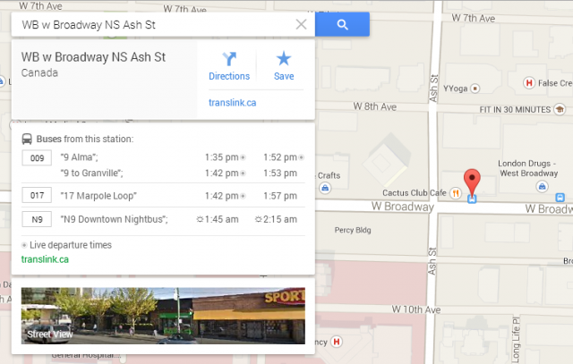
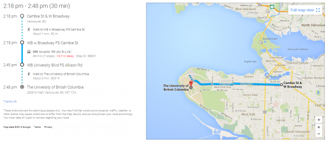
We have some great news transit riders: Google Maps has live departure times now!
Through the new GTFS real-time API, Google Maps is now able to provide real-time transit information like our Next Bus feature. It is able to display predicted departure times (based on GPS data) instead of scheduled departure times.
This means riders using Google Maps to plan their trip will be able to know more accurately when they will arrive at their destination. As an added bonus, Google Maps also provides an estimated walking time when you’re off transit.
GTFS real-time is a different way of processing the real-time transit data already available through Real Time Transit Information (RTTI). It will offer developers greater flexibility to create even more amazing apps built with our shared and free transit data.
Developers can visit developer.translink.ca to register for an API key to access our GTFS real-time, RTTI, and Regional Traffic Data System (RTDS) open APIs.
Let us know how you’ll be using this new data and Google Maps feature!
Author: Allen Tung