More T signage is now up in downtown Vancouver
January 7, 2010
More T signage is now up in downtown Vancouver
January 7, 2010
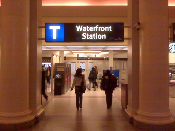
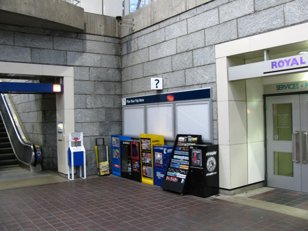
In case you haven’t seen it , more new wayfinding signage has now been installed at Expo and Millennium Line stations in downtown Vancouver!
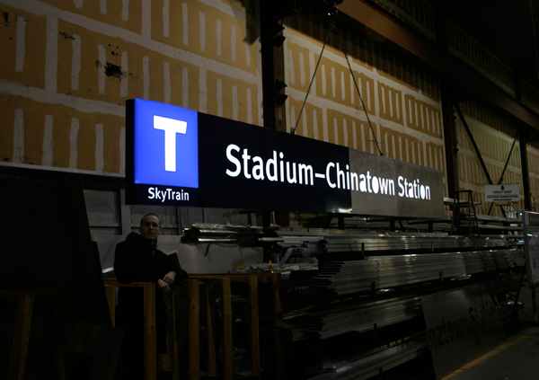
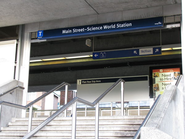
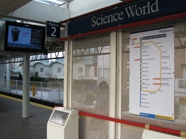
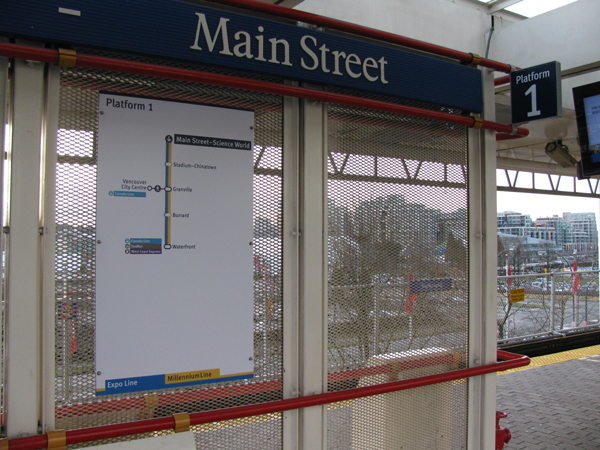
We talked about the new T transit station markers last time, but even more wayfinding signage with the T identifier have been put up. That includes entrance name signs like the one above, SkyTrain line diagrams, and trip planning maps.
Since many have asked, the T beacons and horizontal entrance name signs will light up. Some sites are still working on getting power to the signs, so they’re just not all illuminated yet.
Read on to see more photos!
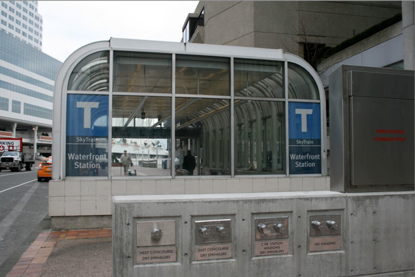
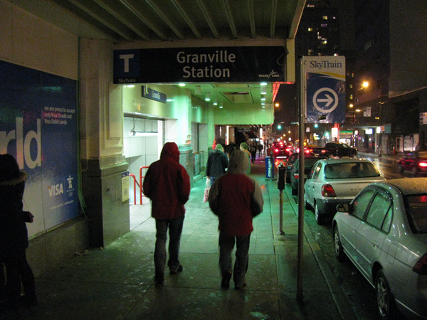
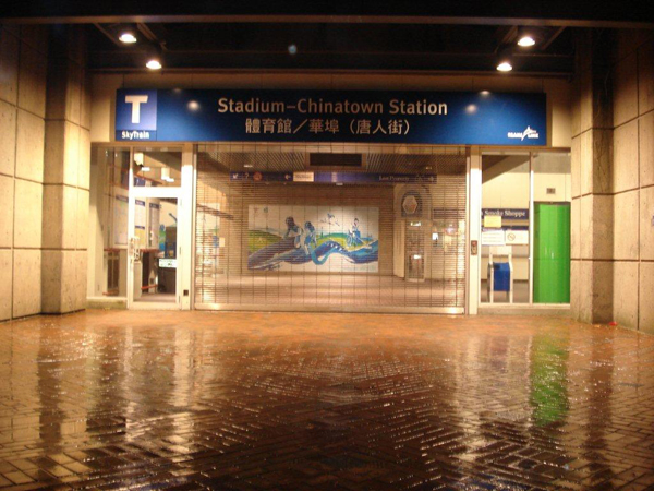


[…] The Buzzer blog » More T signage is now up in downtown Vancouver buzzer.translink.ca/index.php/2010/01/more-t-signage-is-now-up-in-downtown-vancouver – view page – cached In case you haven’t seen it , more new wayfinding signage has now been installed at Expo and Millennium Line stations in downtown Vancouver! […]
Hey! That’s great how there’s Chinese on the sign at Stadium-Chinatown Station! But it’s too bad the other stations still only have English on the new signs.
I’ve always wondered about this – the signs at platform level at Main Street-Science World Station say “Science World-Main Street.” Thats a little strange.
Today I’ll be taking the Sea Bus to Vancouver – so I’ll keep an eye out for the “T” sign! :)
Hi Jhenifer. Can we assume that the newspaper stands are being removed once the information boards are filled at Burrard? Many people need to stand close to information boards in order to be able to read them!
This new signage looks very nice, very sharp: like I said before, for the first time, the Metro region’s hodgepodge of diverse transit services finally has a proper unified branding strategy.
The platform line maps are an excellent adaptation of a common practice in many other rapid transit systems.
May I ask, though…what’s the deal with the angled edge on the upper right-and arm of the “T”? Is it supposed to evoke an arrow or something? Just curious…
How come the Waterfront Station sign has no text beneath the “T” glyph, while all of the others shown are subtitled with “SkyTrain”? A design mistake?
-ben
Hey, I’m passing on all your questions to the wayfinding team! I have one answer so far for Stefan:
Thanks for the quick response, Jhenifer!
I was digging up information about the design contractor (Access Information Group, out of the UK). It looks like they’ve done some very nice stuff in other places.
Any plan to redesign the TransLink website, bus stop signs, timetables, etc. eventually, to conform to this new program?
Too bad this was not done last summer. The A-Team movie was filmed in Vancouver. Mr. T would have been proud.
Stefan: here’s the answer to your second question from the wayfinding team.
I noticed that the old route maps are stil up in some of the ST stations like Granville. They indicate travel to Richmond via #98 bus. I had to direct a visitor from Atlanta to the nearest CL station because he was very confused and lost. Will BCRTC be removing these outdated boards?
Ooh – those maps should all be down! I’ve passed your note along now and hopefully it will be remedied.
OK, I’ve heard back now. e-eye, would you mind telling us exactly where you saw the map in the station, so it can be taken down?
The ones I saw (so far) are in the Dunsmuir entrance to the Granville station on the concourse level (near StarBuck’s) and at the inbound platform level (near the elevator). If I see others, I will send additional information.
John Hodgkins: So! Answers!
Right now, I’m told that the boxes are contracted to be in that position, but we can definitely renegotiate to have them moved. However, all newspaper boxes are actually going to be removed for the Olympic period due to security concerns, so they won’t really be in front of the wayfinding maps for the next little while anyway. And we can use that time to find a good spot for them post-Games :)
I like the new look. I’ve had to help a lot of people find their way around and directing people to Canada Line from the Expo Line platform at Waterfront isn’t as easy as it sounds. People were getting lost only a few metres from their destination because the signs I thought were sufficient weren’t enough for them.
Waterfront obviously doesn’t have SkyTrain under the T because it’s also home to SeaBus and West Coast Express.
ben K:
Yes, as David suggests, the Waterfront sign doesn’t have SkyTrain under the T because the station provides many different services. However, the Waterfront sign at the Howe Street entrance does have SkyTrain written underneath. Here’s what I’m told about that:
I was at the new bridgeport station the other day and noticed the hand info maps/boards on the poles at the bus stops… the only thing is ‘highway’ is spelt wrong on it!
First thing I thought when I started seeing those “T” signs popping up was that they were a blatant rip-off of the T-Bana signage in Stockholm, Sweden.
Dan:
Can you tell us exactly where you saw the “highway” misspelling? The wayfinding team has told me that there are 11 bays with 3 infocube faces each, and a large quantity of text on most infocube faces — so they would love to know just where the error is!
surely a big ‘t’ would be eye-catching, but it takes time to understand what it really stands for. with tourists from all corners of the globe coming soon for the olympics, why would translink decide to adopt a textual signage, when their mother tongue isnt just english? translink needs to bear in mind that symbols are the common language that speaks to everyone. to express a transit terminal such as waterfront, the translink logo or a symbol combination of bus, skytrain, seabus and west coast express is much more effective than a ‘t’ which draws confusion as a taxi stand. just my two cents.
Jhenifer:
I really like this whole program.
If we’re going to pick nits, however, I have one about the large “spider map” on the central information board in the middle of the Bridgeport Station bus loop showing all the bus routes serving the station.
Overall, the map is a very good idea, and very well executed. Nevertheless, there’s one small detail: it shows South of Fraser services (300s and 600s) as going south on Garden City, east on Cambie, then southeast on Highway 99; whereas they don’t run along Cambie at all, and rather go east on Sea Island Way. Since Sea Island Way is obscured by the large box listing the routes serving Bridgeport Station, those routes could just be shown as lines projecting southeast on Highway 99, out the of the lower right-hand corner of the box. (If someone looks at the map, they’ll see what I mean.)
This is a very minor thing—regardless of which street the buses go down, they don’t stop anyhow, being expresses—but it’s been bugging me since day one.
Thanks!
Thanks Stefan — I’ve passed your comment on to the wayfinding team!
It was at the bus stop enroute to Ikea at Bridgeport skytrain – sorry I don’t remember the bus number, but the typo was on the driving map on the infocube… it was spelt “highaway”
I found T sign at Waterfront station Howe Street entrance very difficult to see, especially on sunny days, as they are translucent.
Maybe they can put another opaque T sign stickers on the inside of the glass to improve the visibility.
I thought the “T” signs were for the canadaline.. speaking of which why does it look so plain? couldn’t they have styled the letter “T” a lil more Stylisly? example like the TTC their logo is a bit more original compaired to what we got; but I like the stadium – chinatown light up sign :)
I thought it was only for the Canada Line as well. Perhaps this is the future logo for Translink.
Looks like the captions for the Main Street-Science World Station photos are reversed!
Robert: Oops! Will fix.
Clarification on the previous comment – applies to references to platforms 1 and 2.
Well, this is not related to the wayfinding, but there are quite a few errors on the system map I’ve noticed:
– The following routes should be peak-only (but marked as all day service on map): #311, #388, #595 at Maple Meadows Stn
– The following routes has improved to all-day service quite some time ago: #345, #C40, #C74 to Surrey Central
– The #375 is incorrectly shown as #374 on 152 street near White Rock (this is correct on the WR map, but not the entire system)
– #480 south of Richmond-Brighouse should be purple (this is correct on the Richmond map, but not the entire system)
– #C90 should be limited service – 2 buses per day
– #C26 Buntzen Lake Special is not listed at Coquitlam Station, and the routing is not shown on the map south of Anmore (should be on Barnet)
– #3 to Marine Drive is not a peak-only service, its all day
– All #640 stays on River Road during weekend, so both branches should be marked as black
– #143 is all-day service now, but one “143” was left as blue on Lougheed Hwy
– There is no bus service on Boundary between Hennings and Lougheed
And the followings are just my opinion, for consistency:
– #C48 and #C49 have almost the same schedule, yet one is limited and one is regular service
– #179 and #410 Fraserwood both have similar early evening service, yet one is peak-only and the other is all-day
– The limited #112 and #480 service is shown on the map, but not the following: #4 to Phibbs Exchange (evening), #99 to Boundary, #143 from Poco Centre (early morning), and probably a few more
– #321 to White Rock South should be limited service (not regular) as its early morning and late night only.
Also, wouldn’t it be nice to show the FTN routes as a different colored line on the map? It would do a much better job to let the user pick the routes that have the most frequent service.
;-):
The T signage is meant for the entire system. It’s not supposed to replace the TransLink logo — it’s supposed to stand for “transit”.
snowystar:
Thanks! I passed your comments on to the wayfinding team, and they’ve told me your comments refer to older maps at the stations. Those maps are only printed once a year owing to budget constraints, and more updated info is available online. Did you see the older map at the station recently? Apparently the one you are referring to should have been taken down already.
Acutally, all of the errors are from the latest (Dec 2009) map posted on the website. I haven’t looked at the printed map in detail as I assume they’re the same.
Ouch! OK, I’ll pass that on.
are there going to be T signs on major streets that are maybe a block away, with an arrow pointing to stations, if the station is a little discreet? That might also help.
Tessa:
I passed along your note and here’s the reply.
Hi Jhen, just thought I’d say that I also noticed that buses stopping at Granville & Georgia announce “Granville SkyTrain Station” but not “Vancouver City Centre Canada Line Station”, even the buses that drop off right outside VCC Station’s main entrance (e.g. the north shore buses). Are there plans to change this? Just wondering. Would be good especially for when the trolleys start running down Granville Mall again.
Stefan:
Just wanted to let you know that our consultant on this project is actually called Applied Information Group, not Access Information Group!