SkyTrain historic photos: Princess Diana visits SkyTrain and more
SkyTrain historic photos: Princess Diana visits SkyTrain and more
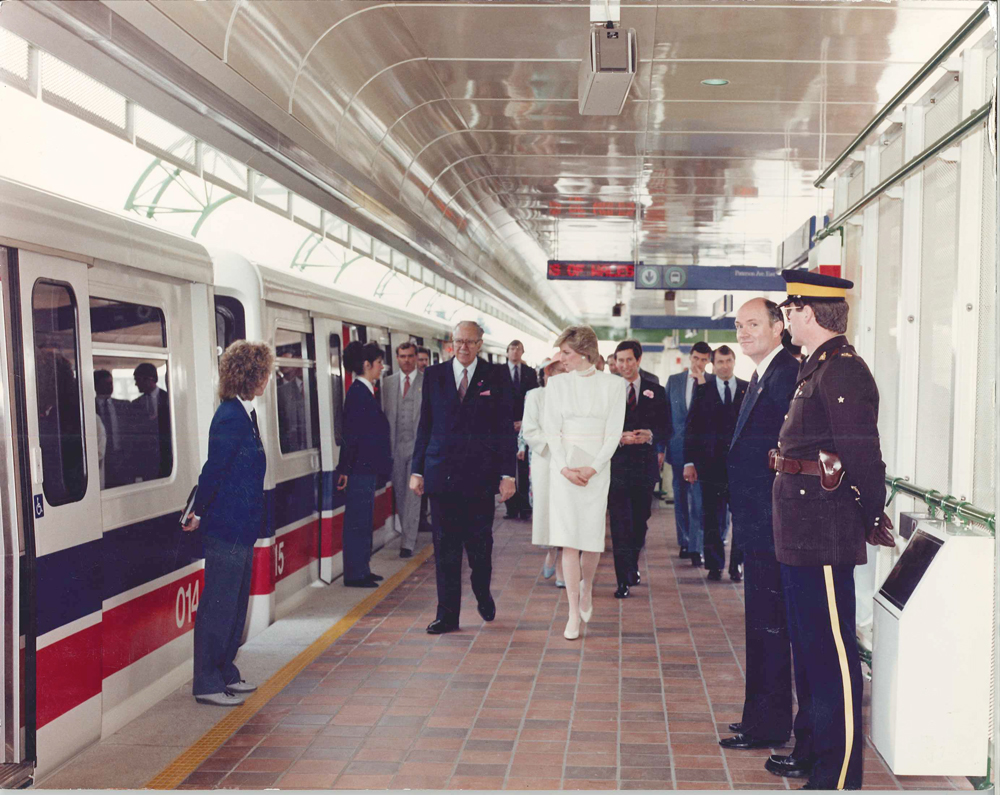
Again, as it’s SkyTrain’s 25th anniversary this year, I’ve assembled some historic photo treats to share with you today!
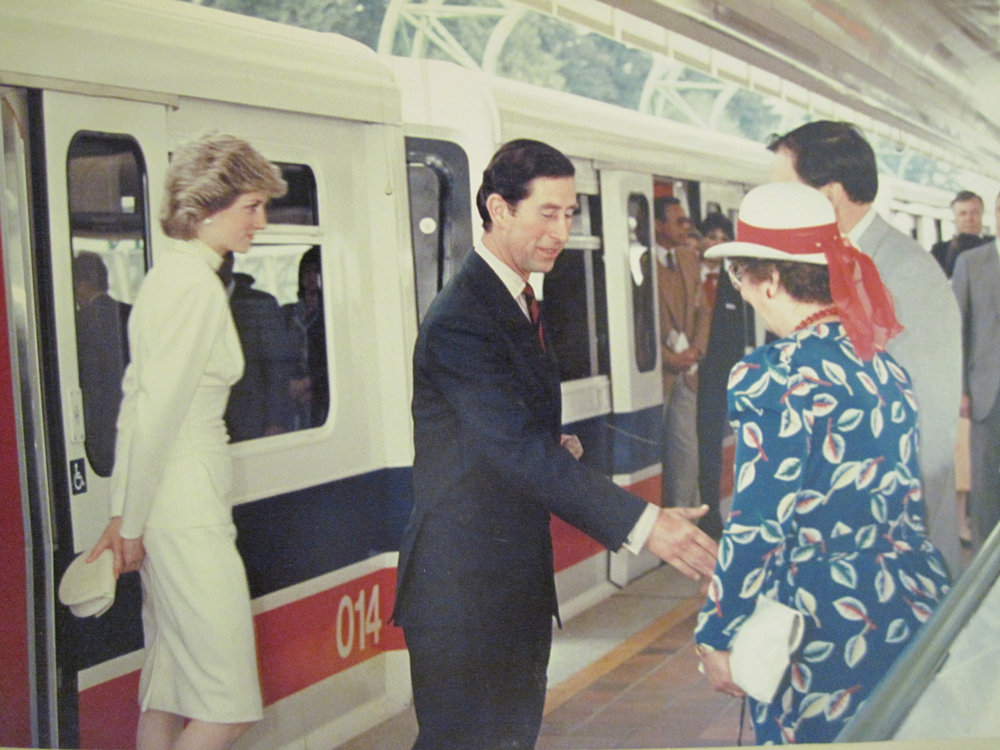
We’ll kick it off with photos of Prince Charles and Diana, Princess of Wales on the SkyTrain, as a couple of people have asked after these. Charles and Diana visited Expo in May of 1986, and rode the brand new SkyTrain from Waterfront to Patterson Station. (Then I assume they went back to Waterfront, although our records are silent on the return leg. Edit: Thomas explains in the comments that they went back to Stadium Station and disembarked there. Thanks!)
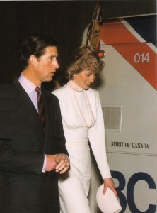
I found the photo above in the TransLink offices: Diana is walking at Patterson Station, with Prince Charles just behind her. The one at right was from the Buzzer’s Jan 20, 2006 issue, and the one below was sent in by Jennifer Siddon at SkyTrain. Also, Global Edmonton has this photo of Charles and Diana apparently heading to Waterfront Station (or does that look like a different station to you?).
Notice that car 014 is the one Diana and Charles rode in! I’m not certain there is a plaque inside it for them, but car 014 does have one for the prince and princess of Belgium, and the princess of Thailand.
I’m not sure why car 014 got to be the bearer of such prestigious guests, but next time you ride it, know that you’ve shared the same space as countless royals!
I’ve collected the remaining photos from around the TransLink and SkyTrain offices: I don’t think they’ve been widely seen before, so hopefully this is all new to you!
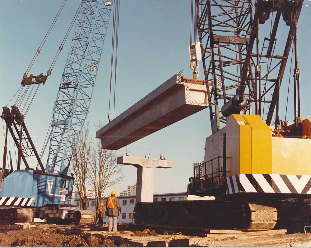
Clearly this is a beam being put into place: can anyone identify where this photo was taken though? I’m not certain the surroundings are descriptive enough to help us figure it out!
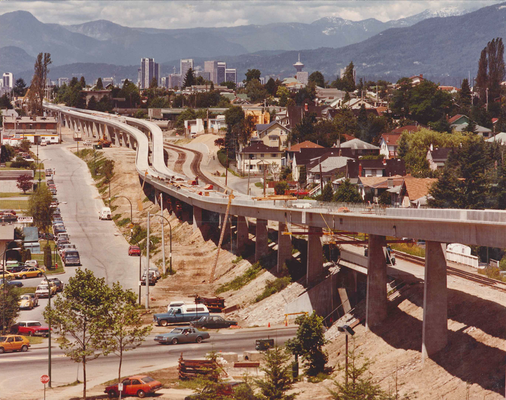
There’s no location given for this photo either, but I consulted my colleague who is exceptional at figuring out geography, and he said, “I believe this is facing north-westwards from the Telus Building (used to be the BC Tel building). It’s at Vanness (the small street running parallel to the SkyTrain) and Boundary (the street running underneath the SkyTrain).” This sounds good to me: but if you have a differing view, please do share!
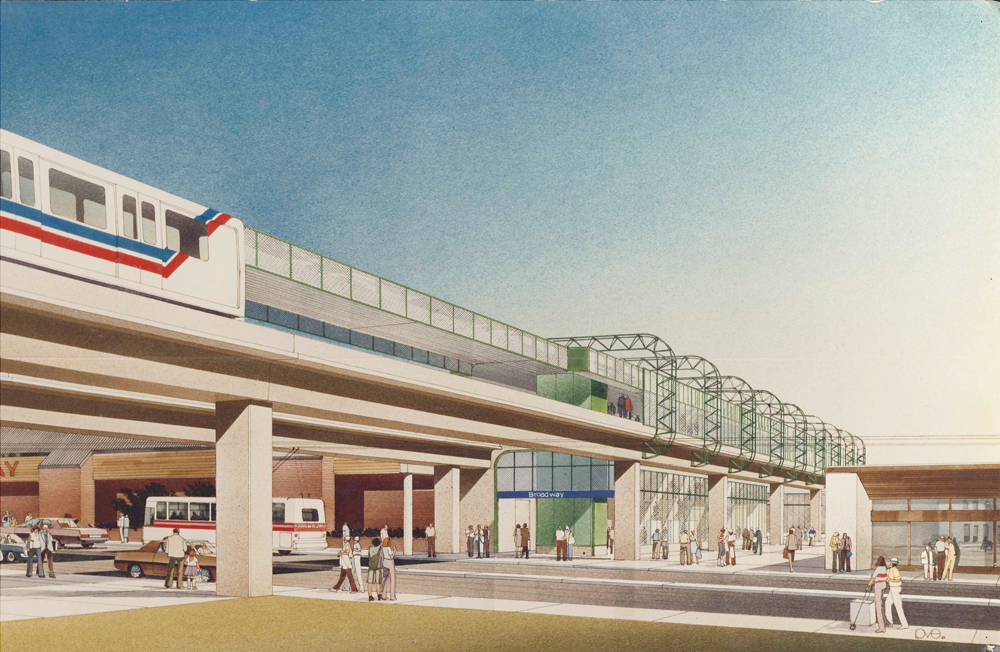
Here’s a conceptual drawing of Broadway Station (now Commercial-Broadway Station). It’s funny how little the station area has actually changed from this drawing!
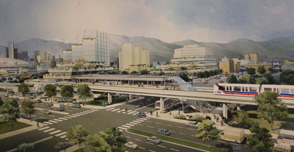
And here’s Main Street Station envisioned in pen and ink.
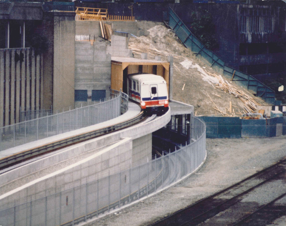
A car coming out of the Dunsmuir Tunnel entrance around Waterfront Station. No date on this one, but it’s definitely early 80s!
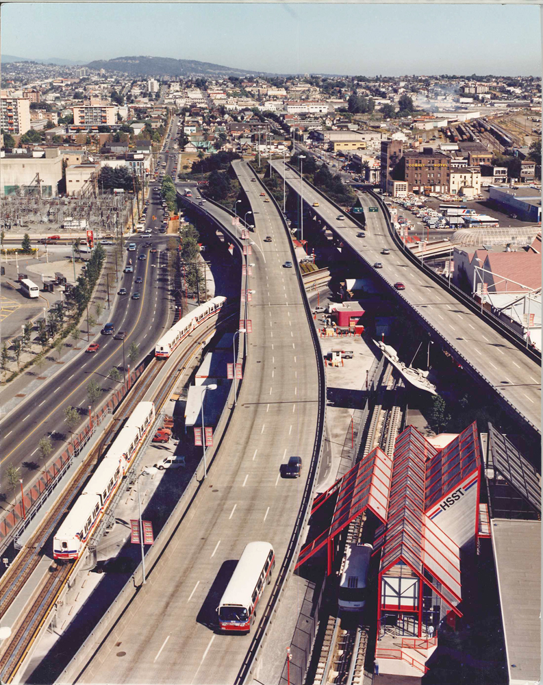
If you want the exact location, the back of this photo says “West of switch 12, Stadium Station.” Note the monorail HSST station at lower right, which was the the HSST was mag-lev demo brought in for the Japan pavilion, plus Highway 86, the popular Expo cement sculpture featuring cars and other transportation!
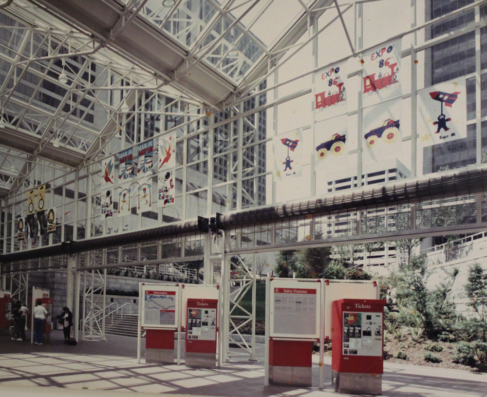
Aw, look how lovely Burrard Station looks! The red of the ticket machines really pops :)
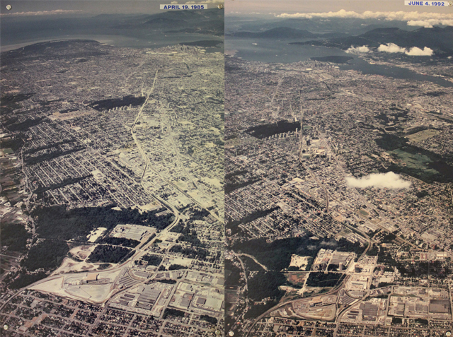
This set of photos is mounted on the walls of the SkyTrain operations and maintenance centre: it shows the SkyTrain route in 1985 and a comparison shot taken in 1992. You can see little towers popping up all along the route! For larger versions of each photo, click here: April 1985, and June 1992.
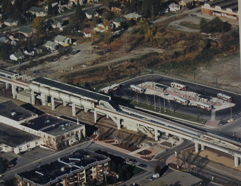
And here’s that classic photo of Metrotown Station back at the dawn of SkyTrain. No mall, just a bus exchange!
Remember, you can check out the entire Transit History category for more photos, videos, and stories on SkyTrain’s history and more. Happy 25th, SkyTrain!


Love the images….
With the Olympics anniversary around the corner, I’m dissappointed we don’t have images of the Torch on the Canada Line. I guess it’s really too late to pull the security footage.
My heavens Diana was such a beautiful beautiful woman. You could never take an ugly photo of that woman – give her a potato sack and it’d look like an evening gown. It’s hard to believe it’s been 25 years since Expo — I was just a teenager but I’d spend virtually every spare day there I could with my dog pack of four buddies having the best fun.
One tiny comment to whoever runs this blog on behalf of SkyTrain — I find that the signage was better done and clearer in the 80s. The green circles around the bus and sea bus signs, the grey colour with very brightly circled arrows, and ticket machines that stated their purpose. Sorry, it’s just that the system I suppose seemed more standardized then.
Anywho – yes. Keep peace.
Thanks for the feedback Helga: I’ll pass it on to our wayfinding (signage) folks. Also, glad you enjoyed the Diana photos!
[…] This post was mentioned on Twitter by The Buzzer, Andrew Devlin and TransLink BC, Jason M Vanderhill. Jason M Vanderhill said: RT @thebuzzer: New blog post: SkyTrain historic photos: Princess Diana visits SkyTrain and more http://ow.ly/1aY7vf […]
In the second photo of the post, with the close-up of Prince Charles, Princess Diana, and SkyTrain car 014, is that a flag hanging on the car? If so, what flag is it?
ericmk: It looks like the BC provincial flag hanging flat? http://en.wikipedia.org/wiki/Flag_of_British_Columbia
The March 1984 photo looks like it could be Metrotown – the 2-story building in the background looks similar in style to the one shown in the Metrotown photo. On the other hand, based on the 1985 Aerial photo, I don’t see any apartment buildings in the direction that the camera’s looking (likely south, given angle of the track at that section and the fact that the sun never shines on the north side of things). However, if a similar two-story building was available at the Patterson area, then those apartments could very well be the ones next to Central Park.
So my bet would be on the Patterson area, just slightly east of Central Park.
Actually, I think that’s the flag of Prince Charles:
http://www.crwflags.com/fotw/flags/gb_rocha.html
Note the white bar with the vertical bar over the lion, which you can see on the photo.
What would we do without you Tim? Thanks for all the super sleuthing: the white bar definitely indicates it’s the flag of Prince Charles, rather than the BC flag.
@ “west of switch12, stadium”, the HSST was mag-lev demo brought in for the japan pavilion.
The road scultpure was called highway 86.
my guess is that the pic was taken from the large flag pole at expo, now at a car dealership in guildford. either that or from a cat walk from the scream machine.
Now i feel old….:-(
After returning from Patterson Station (where they inspected a new children’s playground, I believe), Charles and Diana got off at Stadium Station. The platform was cordoned off, but I got to see her from the mezzanine.
Thomas: thanks for the info! I’ll update the post.
Jhenifer wrote: “I’m not sure why car 014 got to be the bearer of such prestigious guests, but next time you ride it, know that you’ve shared the same space as countless royals!”
I think the answer is in the second photo, showing Charles and Diana near the end of the car. It’s name is “Spirit of Canada”. Don’t go looking for it now. It was later renamed “Spirit of Williams Lake” and still carries that name.
Jhenifer, maybe your excellent SkyTrain source can tell you how long 014 had the “Spirit of Canada” name. Did it start life with that name or did it start with the “Williams Lake” name and temporarily take on a new identity for the Expo period?
Always glad to help!
Building on Ian’s post, why 014 for Spirit of Canada?
I’ve sent both your notes about 014 over to SkyTrain: we’ll see what they have for us!
Is that car 015 behind 014 in the very first photo?
The even-numbered car in a SkyTrain married pair will always wear the higher number. Example: 013/014, 015/016 and so on. So where is car 013? Perhaps changed for a less superstitious number? That’s a bigger job then simply uncoupling a train!
This is a very rare and interesting photo for sure!!
Jhenifer:
Wow, wow, wow, wow: such a nostalgia bonanza today! Thanks–I guess you ran with my comment on the last SkyTrain post!
Yes, the 5th photo is indeed almost certainly looking straight up Vanness from the east side of Boundary.
And I remember Metrotown Station from even before that last photo was taken! Judging by the number of buses (and lack of other development), it must date from the summer of ’86, or thereabouts. But bus service to the stations was phased in gradually, and in January and February of that year, only the 41 (yes, 41) and 130 served Metrotown Station. I took the 41 out there from Kerrisdale one day, and the loop was an empty, forlorn place, with those big, empty lots on the north side, and only a single 130 passing through on its route between Kootenay Loop and Marine at Greenall.
You’ll notice an access road in the foreground, crossing under the tracks. At that time, Central Boulevard only went through from Sussex (east of the loop; now replaced by the Metropolis parkade entrances) to Willingdon. Buses coming from the south (114, 115, 116; now C5 and C6) had to access the loop via that roadway, which has since been closed off (but you can still see remnants of it).
Alan M:
Were cars 014 and 015 paired, or simply coupled? It’s hard to tell from the photo. Apparently, there is (or was) a car 013: the Spirit of Quesnel, which is in keeping geographically with car 014’s later name (Spirit of Williams Lake).
I recently found this web page listing all the SkyTrain car names:
http://barp.ca/bus/bctransit/vancouver/skytrainroster.html
No mention of car 014’s early history, but on that page, car 051 is listed as the Spirit of Canada. So what happened?
Also, evidently, car 043 is (or was) the Spirit of Expo ’86, not the more logical car 086 (Spirit of Revelstoke). Why, oh why!? Was it not delivered in time?
Mezzanine:
Yes, the Japanese maglev!!! I remember that well! Also the wild and crazy model transportation layout they had inside the pavilion.
But what’s the deal with the BC Transit buses on the Dunsmuir Viaduct? They must be PM peak hour deadheads from Surrey or Port Coquitlam, because no revenue buses ever operated along there (at least not since the 1970s).
Tim:
East of Patterson would be my guess, too. It doesn’t match any of the lowrises that remain along Beresford east of Willingdon, especially because there are no highrises like that in the background, at that angle (looking southeast). And the only place in that part of Burnaby where there were highrise apartments in the early ’80s was indeed the Patterson area east of Central Park, which must have since been torn down.
Correction to very last sentence: I meant, there must have been a lowrise there which has since been torn down.
And Tim: good eye re the flag in the 2nd photo!
I’m going to agree with mezzanine the image was taken from the flag pole at that high vantage point.
Looking at the map, Jhen has it wrong about monorail station. The monorail station would have be behind the flag pole and impossible to have in the image looking East. That train at the bottom is the HSST from the Japan pavillion.
http://bobbea.com/expo-86/largemap.html
Anyhow, yeah, that is most definitely the Japanese maglev, which ran back and forth on a short segment of track. And Mezzanine had a good eye to spot the northernmost end of “Highway 86”!
The monorail guideway was off-photo, further to the south (right), then curving around west of (below) the photo, to come alongside the third platform at Stadium Station, squeezing into the narrow gap between the station and the Dunsmuir Viaduct. That’s where passengers transferred to and from Canada Place via the SkyTrain shuttle, by simply crossing the shared platform. From there, the guideway curved around in the lot where the Costco is now. I vaguely recall that the monorail storage and maintenance facility was there. (You can just see it at the very top of the map ;-) linked to, coming down south from Stadium Station.)
Those pictures of the viaducts are something else! It really brings the idea of ‘urban fabric’ home. If you look closely you’ll see a plethora of transportation modes and companies. That’s a one of a kind picture for Vancouver right there!
The thing about those old photos is the chemicals are falling apart. Check out these pictures of Metrotown in 1982 and 1985.
http://www.globalairphotos.com/images/bc/burnaby/1982/byh1982_003.jpg
http://www.globalairphotos.com/images/bc/burnaby/1985/byh1985_056.jpg
Sears was the only thing at Metrotown in 1982. The mall today really envelops the department store.
Here’s another view of the Metrotown bus loop before it was built.
http://www.globalairphotos.com/images/bc/burnaby/1985/byh1985_025.jpg
This fellow sells his images online. But his website and images are great at going back in time.
http://www.globalairphotos.com/gallery/BC/Lower_Mainland
Here’s another angle around the Japanese pavillion where you can see the monorail just skims past flag to get to the Stadium skytrain station and returns to the Plaza of Nations.
http://www.globalairphotos.com/images/bc/vancouver/1986/vch1986_006.jpg
http://www.globalairphotos.com/images/bc/vancouver/1986/vch1986_008.jpg
While the future of the viaducts remains to be seen as they are coming to end of life, they are not the first. Here’s some images of it’s predecessor.
http://vancouver.ca/ctyclerk/archives/PHOTOS/A63/A63484.JPG
http://vancouver.ca/ctyclerk/archives/PHOTOS/A64/A64131.JPG
Click on the images to zoom in.
And more images before Expo…
http://vancouver.ca/ctyclerk/archives/photos/cva1184/sub1/A10702.jpg
http://vancouver.ca/ctyclerk/archives/PHOTOS/A63/A63484.JPG
I hear the main reason the viaduct was replaced is because it was under engineered. While attractive as the Burrard bridge, the bridge had barely the strength to support the street lights.
While it makes perfect sense for the Metrotown station to be located where it is today, with Save-On, Metropolis and the library nearby. I always wondered why Metrotown station was not located further East in front of where Zellers is today.
It would have been a much shorter walk. Getting to Sears was such as hassle in the 90’s as I had to cross the Metropolis overpass to get to the Skytrain station.
Also, why was Metrotown choosen as a critical station? The only thing there was Sears. There was no major crossroads.
;-)
Those are great photos: thanks for that!
Apparently, the old Georgia Viaduct even had streetcar tracks laid down its middle, but they were never hooked up at either end, and never used. Even until a couple of years ago (or even now, still?), the short stub of East Georgia on the west side of Main had remnants of the old streetcar tracks still in place.
As for Metrotown, one can only guess that the redevelopment plans for the area were already in place, and the station’s location was based on that. Even before those old warehouses were torn down and Metrotown Centre was built, the Save-on-Foods was built to the northwest of the station, later to be integrated into Station Square. There must have been some anticipation of how the whole thing would look at the end, and how Metrotown fit into that.
The transit hub at the time was located over at Kingsway and Nelson, by the old Super-Valu (in the northeast corner of the mall property) and the 4900 Kingsway complex that had already been built. So there must have been a compelling reason to shift the station quite a bit further west from there (and not, say, where the tracks cross Nelson).
Actually, Metrotown is a case study in the carrying out of a long-range vision! Burnaby’s planners put out their first redevelopment plan for Burnaby’s future urban centre way back in the 1960s, and the oldest office highrises along Kingsway west of Willingdon came out of that plan, and have been there at least since the 1970s (including the GVRD’s offices).
…Also, I was wrong about the location of the storage yard for the Expo monorail. The first 9:32 p.m. photo that ;-) linked to shows the yard under the Georgia Viaduct, just beside the Scream Machine (the big red and white roller coaster).
Because a normal switch doesn’t work for a monorail guideway, they mave have used something like a transfer table to move trains off of the through track onto the storage tracks.
In the second photo, you get a very clear view of the maglev train, and how long its demo track was, tucked in there under the viaducts.
Great post, thanks for putting this together!
[…] Images via The Buzzer blog! […]
;-): Just to build on what Sewing mentions, Metrotown has indeed been long designated by Burnaby city planners as one of their “town centres,” or places where they wanted to build up density & services. So that’s why Metrotown Station got placed there, in the middle of nowhere at the time—it was anticipating the densification!
;-), mezzanine: Btw, I’ll fix the reference to the monorail and swap it out for HSST!
I am very confident that that photo is near the Telus building. At the time, it was BC Tel, if I recall correctly. I remember being able to ride my bike over the traffic, because of the bridge. Later on, I went back, and I was completely baffled. I couldn’t find the bridge, and I couldn’t figure out what happened, until it dawned on me that they removed the tracks. At the time, I wasn’t used to the idea of removing tracks. Now it seems all too common.
It just dawned on me that the photo above the “Telus building” photo probably was taken somewhere in between Metrotown and Nanaimo. The apartment buildings seem to be consistent with those neighbourhoods.
After looking at some of the archival photos, one thing that I wish Tranlink would bring back is decorative banners in some of the stations. The Burrard Station is a good example.
Ian S: Well, we finally have an answer! My contact over at SkyTrain says our records show that “Spirit of Williams Lake” was the original name of car 014, but there’s no record of the change to “Spirit of Canada.” But obviously it WAS changed to that during Expo, so we can surmise that it was very likely temporarily changed for Expo, then changed back again afterwards.
for picture at boundary and Vanness, i wonder the railway track running along the skytrain goes to where from new west?
[…] After seeing a couple of early SkyTrain drawings, Buzzer pal Jason Vanderhill went in search of the artist… and found Ron Love, a longtime […]
for the last pic I’m pretty sure Metrotown was there or was at least in deep construction. That empty lot by the bus loop would have been mostly Station Square which was built after 86.
I just can’t with Tina Brown. Every time I get The Royalist newsletter (from The Daily Beast) I am reminded that Tina Brown started TDB, even if she doesn’t oversee the newsletter. It is so consistently nasty to Harry and Meghan that it’s hard to take seriously.
princess diana eagles jacket
So 014 was temporarily named “Spirit of Canada” and used for special guests… In the photo, it’s funny how they went through the trouble and coupled it with 015 instead of the normal 013 for… superstitious reasons? Of all the cars they could’ve picked, why 014? Does it / did it have features that are unique to that one? I know BC Transit skipped certain numbers for some reason. 059 – 060 and 119 – 120 comes to mind, but I can’t remember the rest. Each Mark I car developed a certain “character” as the years went on (varying state of wear and tear, different liveries, uneven level of refurbishment, etc) but they sound cool (especially when they start moving). It’s always interesting to find out the history of certain units and look at pictures from the past to see how much has changed since then.
Such an interesting article here. I was searching for something like that for quite a long time and at last I have found it here. Batman Bomber Jacket