Growth south of the Fraser – Part 2
Growth south of the Fraser – Part 2
If you read the interview with Christina DeMarco of Metro Vancouver and looked at the maps addressing growth south of the Fraser River, you know that there are a few regional city centres where people and jobs are projected to increase dramatically over the next 30 years. Working with Metro Vancouver, TransLink has taken the population growth statistics of this area provided by the Metro Vancouver 2040 Shaping Our Future Regional Growth Strategy and has used them for the multi-phased Surrey Rapid Transit study.
Dan Freeman, a Senior Planner at TransLink, provided me with some nice maps and info that further illustrate where growth is expected to explode in the region.

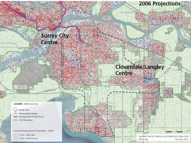
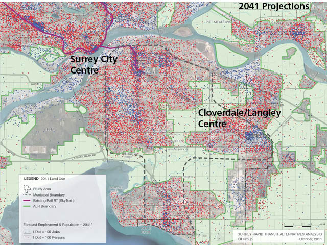
The black broken oddly-shaped line on the maps indicate the study area. Black dots (if you can see them) are municipal boundaries. The red lines are the SkyTrain lines, and the green lines are the ALR (Agricultural Land Reserve) Boundary. One red dot represents 100 persons, and a blue dot represents 100 jobs. Here’s another map of the area to get your barrings.
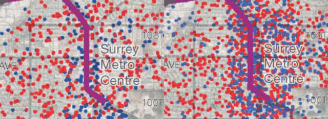
Looking at the two maps, you’ll see how much more populated Surrey City Centre will be in 2041. Dan tells me that in thirty years, the population in this centre will jump from roughly twenty thousand to almost eighty thousand people.

Surrey City Centre will be very important to the transit network because of its connection to the SkyTrain system, bus services and a place where some forty thousand jobs are projected for 2041.

Another significant change in population growth is along the Fraser Highway, particularly close to Langley, Cloverdale and the Clayton area in Surrey. Until recently, population growth has been in that area between Fraser Highway & Highway 10. In the future, almost all of the growth is expected north of the Fraser Highway in the Clayton area.

So it’s these insights into what’s going on south of the Fraser in thirty years that the planning department at TransLink is working on today.
If you have any thoughts about these projections and what they mean for transit, I’d be more than happy to ask Dan and others in the planning department to respond and answer any questions.


Hi!
Re-twit you post: to my @urciibqo twitter