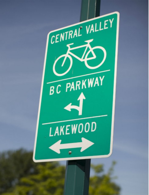
Psst….psst…do you use the BC Parkway?
September 30, 2014
|By Angela Salehi
Psst….psst…do you use the BC Parkway?
September 30, 2014
|By Angela Salehi

I’ve got good news if you cycle or walk along this 26-kilometre, multi-use path. We are making safety and accessibility improvements along the BC Parkway which connects Surrey, New Westminster, South Burnaby and Vancouver.
These improvements include:
- Realignment of the BC Parkway, away from darker areas and bushes and closer to the road at Nanaimo Station, and along Slocan and Rupert streets.
- New lighting on parts of the parkway in Vancouver, New Westminster and Surrey for increased visibility for BC Parkway users.
- A new designated route at Nanaimo and Patterson SkyTrain stations to separate cyclists from vehicles and pedestrians.
- Widened and paved paths, with new ramps replacing steps at Slocan and Rupert Streets. This improves accessibility for parents with strollers, people in wheelchairs and scooters, and cyclists.
Minor detours will be in place at specific sections of the BC Parkway during construction. Cyclists should watch for signs along the corridor.
For more details on the BC Parkway, check out our previous posts here and here or visit our website.
Author: Angela Salehi


Oh goody – the work that should have been done FIVE years ago is finally starting!
This is only a small part of the work that needs to be done. The whole thing could have been finished already if cycling infrastructure funding wasn’t always pushed back.
Good to see these changes! The section parallel to the guideway between Nanaimo and Slocan has no lighting at all.
Will you also be improving the signage, especially between Trout Lake and Nanaimo Station? The western end of the Parkway is a little murky to decipher, now that the City of Vancouver has extended the Off Broadway further east.
Thank you for putting in the paved path between McGeer (near Joyce station) and Rupert street, but why is there still a blue fence around it many weeks after it was completed?? When will the fence be removed. Many people are riding and walking on it, but unsure if it is officially open.
Hi Dustin, that’s a good question! The fence is still in place around the Rupert to McGeer area because lighting is set to be installed in the upcoming weeks. So far this section of the BC Parkway has had a lot of work done including the removal of old wooden stairs and retaining walls that were in poor condition; building new concrete structural retaining walls; widening and paving the gravel path; building a ramp to replace the stairs at Rupert to improve accessibility; upgrading two plazas; and planting new landscaping. The lighting installation is one of the last steps. When the lights are in place the fence will be removed and the path will be officially opened to the public!
I noticed some new BC Parkway signage at John Hendry Park (Trout Lake), but it’s really small, at least compared with what was there before. You wouldn’t know it’s there unless you watch out for it. Is there any way to make those signs at least as large as those made by the City of Vancouver?
Hi Eric, you’re right, we also noticed that the route marker signs (with arrows) are too small during our review of the new BC Parkway Wayfinding signs. We are now in the process of replacing them with larger signage.
The story with the small route markers is that they were designed to minimize sign clutter, but now that we are using taller poles to minimize graffiti, the signs are too small. We kept most of the existing route markers, removed the old 7-11 signs and are replacing the smaller route marker signs.The new Wayfinding signs with destinations and distances are designed to be legible while riding a bike.