#WhatsTheLink: TransLink manages 2,300 lane kilometres of road
#WhatsTheLink: TransLink manages 2,300 lane kilometres of road

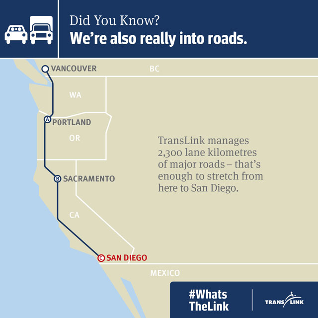
Our first fact about all that TransLink does has been making the rounds on the web this past week. The graphic above shows just how many lane kilometres TransLink is responsible. Unfortunately, we can’t reorganize these roads in the Major Road Network. They’re busy moving people and goods around the region!
You might be thinking that you’ve seen the above graphic before. Well, you’re partly right. We posted a similar image in February. The number of kilometres has been updated for this latest image. Not all the roads we manage are part of the MRN. Therefore, we’ll just have to dream of sunny spots of California rather than Mexico ;).
This first fact has been shared with local blogs along with some stories about the MRN and Kingsway written by yours truly. In case you haven’t come across them yet, here’s a snippet from each. I encourage you to read them in their entirety. Let us know what you think.
Miss 604: Macrons and Kingsway are part of your Major Road Network
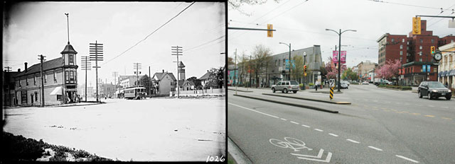
Kingsway is a road unlike any other in Metro Vancouver. At first a walking trail for local First Nations, it then became a wagon road in the mid-19th century….Kingsway is also part of TransLink’s Major Road Network (MRN). The MRN is a network of major arterial roads that stretches across the region and connects people and transports goods across municipal boundaries.

Walking the north end of Kingsway you find yourself surround by all types of business and people. Coffee drinkers imbibe at coffee shops next to hair salons, eateries and various shops.
One place I stopped in was the unassuming bakery at 81 Kingsway. It was the pastel colours of macarons that caught my eye and the smell of butter that lured me through the doors of French Made Baking. Once inside, I was met by almond croissants hot from the oven and Parisian-accented English.
VancityBuzz: From trail to street, Kingsway is part of our history and the Major Road Network
Have you ever wondered why Kingsway is unlike other roads in Metro Vancouver? Why, unlike most streets in Vancouver and Burnaby, does Kingsway cut across the grid in a seemingly brazen diagonal from the northwest to the southeast?
The answer is that Kingsway is older than most roads in the region. It came into being before our cities were well established and before planners had the bright idea to make a system of roads following a grid design….

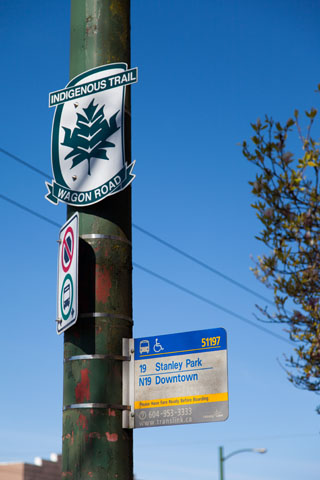
In 2012, the City of Vancouver commissioned artist Sonny Assu to design a street marker as part of Vancouver’s 125th Anniversary. What Sonny created speaks to both the collective history of the street as well as the personal history of the artist. I had the opportunity to ask Sonny as few question about his work and the street that inspired it.
What does Kingsway mean to you?
Nostalgia. With certain stretches that seem lost in time, the element of nostalgia that is inherent within Kingsway is probably the most compelling element of the road itself.
Vancouver Observer: Your Major Road Network Leads to Kingsway
If you’ve ever walked along Kingsway, you might think, like I have, of its history…
The community at Kingsway and Main is diverse. People from around the world and close to home have made this triangle of major roads their place of business. That includes Jae, owner and manager of Gene Café…
“It’s low key, there’s a good community here and there are regular customers. What Gene is today has naturally built up over the years. I really like that about this part of Kingsway. I’ve only been in Vancouver for a short time, but while I’ve been at Gene, I’ve noticed changes in the area. There are more buildings, and we’re a little busier now than we were a year ago.”

Storify: #WhatsTheLink: Major Road Network (MRN)
We also had a guessing game on our Instagram page asking you to identify different roads that are part of the Major Road Network. Check out our Storify summary to see the different photographs we uploaded!


Local route number designations are a big mess as a local official entity continues to sign deactivated numbered routes. The signs I’m talking about use an odd white background with the shield overlaid as opposed to the more familiar ones installed by the province that have no such background.
So, what’s the story with Kingsway? Does TransLink still regard it as Route 1A/99A or is it simply a hold over to maintain wayfinding with older maps?
Or am I barking up the wrong tree and it’s actually the municipalities putting up the odd looking signs on Kingsway?
Slightly off topic: Any plans to number Golden Ears Way? It’s rather odd to use a shield without a number.
Looking forward to the Canada Line extension to Bellis Fair and beyond.
@ Robert and anybody else
What kinds of sources do you go to to get this information? Is it just stuff that you pick up along the way, in life?
Hi Cliff:
I’m not sure of the signs you’re referring to. Any chance you could send us a picture? As for the indigenous signs on Kingsway, they were commissioned by the City of Vancouver.
???: LOL. If only that were true!
Eugene: I always keep my eyes and ears open. I had heard about Sonny’s work a while back and kept running into his signs when on Kingsway. I’ve also always been interested in Kingsway as a street, so I thought I go out one day and talk to people who live and work on it. I spoke to more people than ended up in these posts. I thought the people I spoke to provided the most compelling info. I hope that answers your question.
On Kingsway at Boundary, erected prior to provincial deactivation of BC-1A and 99A along Kingsway: https://www.google.ca/maps/@49.232357,-123.023673,3a,53y,286.92h,110.29t/data=!3m4!1e1!3m2!1sX3W20FDgT9gWgLDDAksRHg!2e0
Here’s another one of the signs, on Kingsway at Imperial, although with much less of the overlay I was mentioning: https://www.google.ca/maps/@49.221733,-122.978735,3a,15y,124.49h,89.55t/data=!3m4!1e1!3m2!1svRD_WMYoSH7YpMGilxuD4Q!2e0
Again, on Tenth at Sixth in Burnaby: https://www.google.ca/maps/@49.218782,-122.927934,3a,47.1y,241.27h,95.53t/data=!3m4!1e1!3m2!1siqBw6ernoKJPUE-ze7NkTA!2e0
Old overhead sign looks to be a hold over: https://www.google.ca/maps/@49.22319,-122.919791,3a,49.4y,87.47h,84.6t/data=!3m4!1e1!3m2!1sfwzMvcTC2wSH7syU_zD7yg!2e0
This is an old sign on McBride, erected prior to deactivation: https://www.google.ca/maps/@49.221351,-122.91076,3a,15y,156.18h,87.74t/data=!3m4!1e1!3m2!1sPqmvbDyAdyHcfWaABW5bdQ!2e0
Here’s the type of sign I’m talking about with the white background on Oak at Broadway. Highway 7 begins at Granville, BC-99 (Hence the “Junction” sign as you come north on Granville) and this sign is accurate, but that’s not provincial standard. Although the province considers Highway 7 to end at Coleman Avenue and notes on TransLink’s site say it ends at Boundary, while virtually every map out there shows it ending at Kingsway: https://www.google.ca/maps/@49.262613,-123.126607,3a,15y,22.76h,84.45t/data=!3m4!1e1!3m2!1sRDG2k01ao9-avpgi-MjtNQ!2e0
Another of the odd signs on Hastings at Boundary, indicating that it is BC-7A, despite deactivation several years ago: https://www.google.ca/maps/@49.281132,-123.024042,3a,15.6y,310.15h,87.88t/data=!3m4!1e1!3m2!1sDs5X4I8wgft1Fiq0ofu9sw!2e0
I don’t even know what’s going on here: https://www.google.ca/maps/@49.277676,-123.0999,3a,15.9y,188.6h,90.21t/data=!3m4!1e1!3m2!1sc07zMVrhdAv9kNadehM3pQ!2e0
Stanadard provincial signage on the Upper Levels, for reference: https://www.google.ca/maps/@49.338216,-123.140124,3a,39.8y,297.28h,91.61t/data=!3m4!1e1!3m2!1swAQBnwwpsHH87zs6Si8aIg!2e0
Basically, why is new non-standard signage being erected on deactivated provincial routes and what role does TransLink have regarding our region’s wayfinding, especially on the major road network? It just sort of looks like everyone’s doing their own thing and not settling on one standard.
Why not number Golden Ears Way? To avoid any issue with existing provincial guidelines, just select numbers that won’t be used by the province. “715”, for example, as it connects Highways 7 and 15 together. And why are exit numbers not used on Golden Ears Way or Knight Street?
Signage is one of the most visible improvements TransLink can do and can be done very cheaply too.
When I first saw this JPG…. It looks like the perfect Canada Line extension. Let’s make it a reality!
http://buzzer.translink.ca/wp-content/uploads/2014/05/MRN_Buzzer.jpg
Here’s another option…
http://www.vancitybuzz.com/2014/05/china-proposes-fund-build-high-speed-rail-beijing-vancouver/