Ask TransLink: our roads engineer Q&A helps move a sign, talks BC Parkway upgrades, and more
Ask TransLink: our roads engineer Q&A helps move a sign, talks BC Parkway upgrades, and more

From April 15 to May 10, you can Ask TransLink! We’re spotlighting one TransLink staff member every week and inviting you to ask them questions about their work. Find out all about the series.

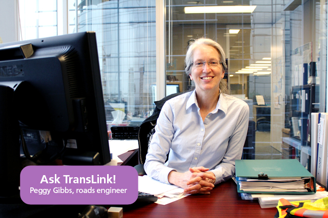
Roads engineer Peggy Gibbs will be wrapping up her Q&A on the blog at noon today, Friday April 19, 2013 – but just before she goes, here’s some of the highlights from her discussion this week!
We moved a sign blocking a cycling path in Richmond

Voony wrote in asking whether this construction sign on Mitchell Island belonged to us, as it was blocking the bike path he uses.
Peggy looked into it, and it got removed! Here’s what she wrote:
The temporary sign appears to be from the City of Richmond’s contractor, and we contacted the City to direct their contractor to relocate it out of the paved path. The sign has now been removed by the City’s contractor.
Talked about upgrades coming for the BC Parkway
Sheba asked about the BC Parkway upgrades and Peggy was able to clarify how things are going, and TransLink participation in cycling infrastructure around the region.
Hi Sheba. Let me take your concerns one at a time.
Regarding the BC Parkway upgrades: TransLink is currently working on those upgrades, based on conceptual designs from the 2009 report you mentioned, now supplemented with detailed designs completed in the last year. The upgrades are expected to start later this year.
Second, regarding TransLink funding for cycling infrastructure: The BC Parkway upgrades are being funded through our dedicated bicycle funding programs (the TransLink-Owned Bicycle Infrastructure program, and the Bicycle Infrastructure Capital Cost Sharing Regional Needs programs), which allocate $2 million every year to bicycle infrastructure. Separate from these programs, each year TransLink funds bike and roads projects on a cost-sharing basis with municipalities. The proportion of these funds that go for bicycle infrastructure varies each year depending on where municipalities direct the funds. This year, about $5M is going for bike projects.
Third, regarding cycling on the BC Parkway: while there are dual paved and gravel pathways along much of the BC Parkway, neither pathway is assigned to a specific user. Please keep in mind that many pedestrians need to walk on the paved pathway, especially pedestrians with mobility limitations, pedestrians pushing strollers, and skaters. We encourage all users – cyclists and pedestrians alike — to be respectful of each other when using the BC Parkway.
Lastly, regarding on-road separated bicycle lanes: On-street cycling facilities are planned, designed and implemented by the agency that owns the road, usually the municipality or province. Our role is to support, through the funding programs I mentioned above, municipalities’ efforts to upgrade their bicycle infrastructure. Where those municipal efforts include on-road separated bike lanes, TransLink might be a supporting partner. For example, TransLink is a funding partner for Vancouver’s Comox-Helmcken Bikeway, which includes a two-way separated bike lane (http://vancouver.ca/streets-transportation/comox-helmcken.aspx).
Answered questions about the speed on streets approaching the Golden Ears Bridge
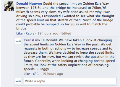
When she answered questions on Facebook, Peggy answered a question about speed limits on the streets approaching the Golden Ears Bridge. Here it is:

There’s still time to ask… submit your questions by noon today!
As mentioned, Peggy is still taking questions until noon today, Friday April 19, 2013—so feel free to send her your questions and we’ll get you some answers!
And next week, look out—we will have bus operator Brian Revel here to answer your questions for a week! Join us on Monday to send in your questions for him!


So now it seems that the UBC Skytrain line will not entirely follow Broadway. The current plan seems to be to travel from VCC to the Great Northern Way Campus and then drop down to Broadway and Main.
Look at page 7
http://former.vancouver.ca/ctyclerk/cclerk/20130424/documents/ptec7.pdf
If that’s going to happen wouldn’t it make more sense to continue on to the Olympic Village Station instead? Then maybe follow W 6th to put a stop over by Granville Island before dropping down to Broadway around Burrard (assuming there’s enough traffic to warrant it). If not then drop the line down right after Olympic Village so that it joins up with Broadway around Willow Street.
Hi Sheba:
Sorry for the delay in the answer. I had a member of our infrastructure planning department answer you questions. Here it is:
Thanks for the question about the UBC Line.
After a detailed multi-year study (technical report available online here – http://www.translink.ca/~/media/Documents/plans_and_projects/rapid_transit_projects/UBC/alternatives_evaluation/UBC_Line_Rapid_Transit_Study_Phase_2_Alternatives_Evaluation.ashx), TransLink has identified 3 viable rapid transit options that could meet the long term needs of the Broadway corridor out to UBC (see the UBC Line Findings Report – http://www.translink.ca/rapidtransit): street level or partially-tunneled LRT, a combo of street-level LRT and tunneled SkyTrain, or a tunneled SkyTrain. These options range in cost from $1.1 billion to $3 billion and each has a variety of benefits and impacts.
One of those 3 options is a tunneled SkyTrain alternative (aka RRT Alternative). It would be an extension of the Millennium Line and so would need to transition north from the current terminus at VCC Clark back towards Broadway via GNW Campus. The study found this to be the best performing of the many SkyTrain alignments considered. The study considered many other route options, however that was the best performing SkyTrain route as it avoids the need to transfer but provides access to the greatest number of destinations through Central Broadway. Among the other viable UBC Line options, the LRT Alternative follows the length of Broadway, and the Combo Alternative includes an LRT line connects to Olympic Village Station and Granville Island.
TransLink hasn’t made a decision about a preferred alternative. The Regional Transportation Strategy taking shape later this year will allow for a regional discussion about trade-offs of each option.
For more about the UBC Line and other rapid transit projects, check out http://www.translink.ca/rapidtransit
We absolutely love your blog and find a lot of your post’s to
be just what I’m looking for. Do you offer guest writers to write
content in your case? I wouldn’t mind producing a post or elaborating on a few
of the subjects you write related to here.
Again, awesome web site!
Cycling paths aren’t taken serious enough in my opinion. they should be used more, as well as respected more. the expenses it takes to create them are vast.
John Bond | http://www.martinhealth.org/heart