Only a few days left to help design the four new B-Line routes
Only a few days left to help design the four new B-Line routes

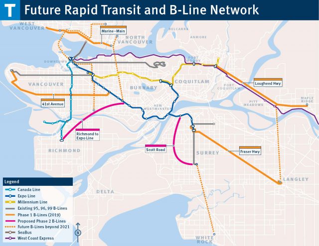
TransLink is rolling out four new B-Line bus routes across 12 Metro Vancouver communities by the end of next year.
When launched, these B-Line routes will bring frequent, reliable service and shorter travel times within walking distance of a whopping 200,000 residents! Now’s the time to help shape these B-Line routes, and make sure they meet your community’s needs. The consultation period has been underway since April and will be closing on May 31.

What makes these B-Line routes special?
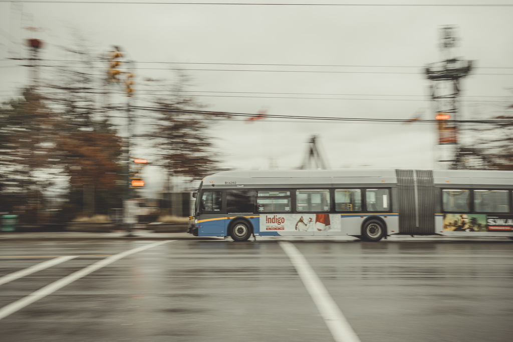
These B-Line bus routes will provide 10-minute-or-better frequency during peak periods, 15-minute-or-better frequency during off peak and operate 18 hours each day—some will be even more frequent. 41st Avenue is the second busiest bus corridor in the entire region (after Broadway), so its B-Line will have a bus every 3-6 minutes at peak times. All buses will be the longer bus with the bendy centre, which carry 50 per cent more people than a standard bus. The buses and stops will have special branding to make them stand out and easier to find.
What also makes these B-Line routes special is that streets will be changed to make sure buses don’t get stuck in traffic. This has the potential to be a big time saver, not only for B-Line riders, but also for people that use other routes along these corridors. We are working closely with municipalities and the B.C.’s Ministry of Transportation and Infrastructure to make such changes a reality.
How can I help design them?
We are currently running an online survey at translink.ca/bline. There are three major elements that need input from the public at this stage of the project:
Where do you want bus stops located?
A key feature of these new B-Lines is improved travel time. One of the main ways to improve travel time is to have fewer stops, so you spend more time moving—just like on a SkyTrain. The stops chosen should be located at the most important destinations and connection points along the corridor.
Together with municipalities in each of the four corridors, we’ve identified possible stop locations that provide the best access to key transit connections, major retail centres and growing neighbourhoods.
How can existing bus routes better serve your community?
The new B-Line routes are expected to attract a lot of riders from existing routes with more frequent, more reliable service and shorter travel times. That makes this a good time to review routes around the B-Line routes to make sure they’re providing the right levels of service. Some routes that connect to the B-Line can expect more riders, so they might need a boost in service. On routes where ridership is expected to drop, service may be reduced and reallocated to higher demand routes in the same community.
For example, on the North Shore, we’re proposing to extend the 240 to Lynn Valley and increase the frequency in the peak to address overcrowding. This would be a massive increase in service to Lynn Valley, despite not being on the B-Line route. In Vancouver, there’s an opportunity to convert the 41 to an electric trolleybus route.
How should streets be changed to keep buses from getting stuck in traffic?

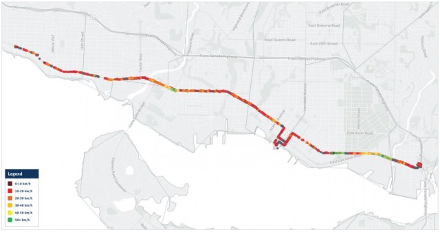
As you can see from the map above, bus travel times on these corridors can be seriously impacted in peak times by congestion. By making changes to the streets the B-Line routes operates on, it could significantly reduce travel time and also help keep buses running on time. These changes will also offer the same benefits to many other bus routes that use the same corridor.
One of the most effective ways to keep bus riders moving is by introducing bus lanes. Other methods include adjusting the traffic signals so buses are more likely to avoid red lights, adding short bus-only lanes at intersections so buses can bypass traffic waiting at red lights, and introducing left turn restrictions to reduce delays caused by turning cars.
We’re working with municipal and provincial partners to examine how streets can be changed to ensure future B-Line routes don’t get stuck in traffic. What do you think? Which of these changes would you like to see in your community? Let them know through the survey.
What comes next?
We’ll be reporting back on the results of the consultation in a few months. Expect another round of consultation next year to discuss recommended changes to streets in more detail. This will guide construction work, happening throughout 2019, in anticipation of the launch in September of that year. Stay tuned!
Take the survey at translink.ca/bline through May 31.


Kingsway
There has to be a specific guideline on how far each bus stop from one another. It should be more frequent so it’s not packed with riders more during peak times if we want our public transportation more reliable. In terms of congestion and traffic B- line must have a B-line only lane and strict rules and penalties for none compliance. Real and honest research on the spacing of bus stops have to be very strategic and when final results are in to have another consultation to make sure nothing was missed and no surprise mistake of OMG how did we miss that !
Marine Drive which goes along with 100. I moved away from marpole area but I recall 100 was very hard to catch off pick hours especially. It runs every 30 mins. There are no alternatives to that on Marine Drive. Which is very long bus route. From marpole to 22nd sky train station.
There is only one bus on Granville st from marine dr to downtown. It is a trolley and stops at every stop. Many disabled take this bus and have no options. I often walk over to get Marpole loop bus to Canada line to get downtown but it’s a long wait for Marpole loop.
For the 41st ave B kine I would sugfest rge stips be the same as the present 43 route stops. At transfer points with north south routes
As I do not use the other routes I will refrain from commenting
Hi John, make sure you take the survey at translink.ca/bline so your feedback on the 41st Avenue B-Line stops is logged.
Transit should be a quick
North, South, East and West….. We live every where….
These half hour waits,
do not work
for our life styles..
And later transit…
Please take a look at EAST RICHMOND we deserve better and more efficient bus route. The buses 410 405 410 are not enough to cover the area of east Richmond and we need upgrade urgently. Also the bus 301 Delta/Richmond needs a bus stop at Alderbridge way before crossing Garden City!
Hi Helena, we took a look at transit and transportation in Richmond as part of Southwest Area Transport Plan. Improvements are planned for the 301, 405 and 410. You can learn more at translink.ca/swatp.
I deplore the 41 B-Line due to the already overcrowded single stop going south outside the UBC Hospital. There is only one stop sign for 7 bus routes, or you have to run all the way back 4-7 bus lengths, making it extremely hard for handicapped people to make this dash for their bus, and to push oncoming people. You often cannot see the bus sign of buses coming to tell if it is your bus.People designing these changes need to walk in a handicapped persons shoes. Drivers will not look behind or wait for you. There needs to one stop/boarding sign per bus number. I have seen drivers rush past blind people waiting for their bus. This is very disrespectful to the handicapped and can easily be fixed. Back to the drawing board.
Shameless