
Have your say on the future of our new Stanley Park bus route
Have your say on the future of our new Stanley Park bus route
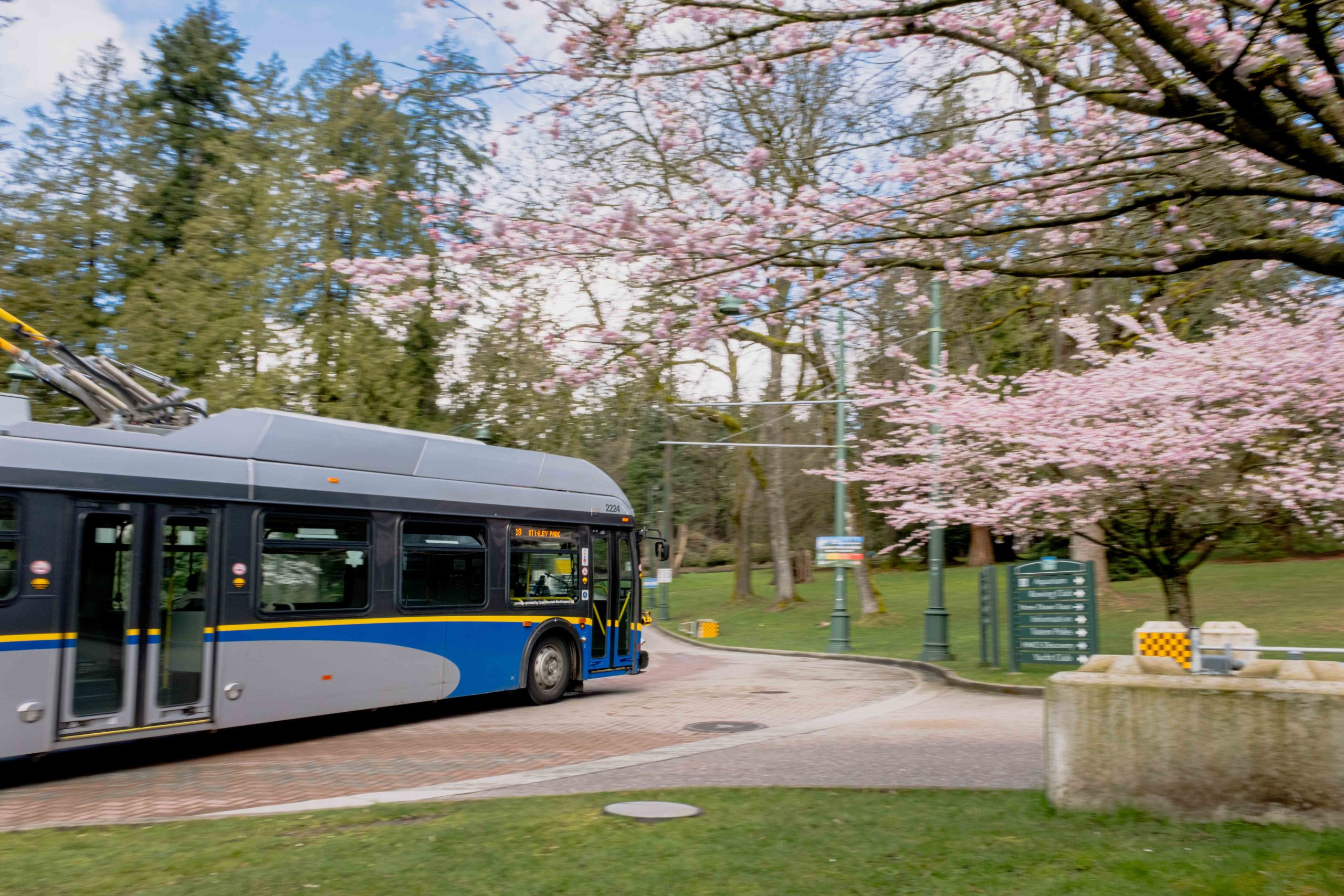
We’re planning a new weekend-only seasonal bus route around Stanley Park, making it easier to reach some of the park’s most popular destinations by transit.
Funded through the 2025 Investment Plan, this route is designed to improve access to Stanley Park while helping reduce parking demand and vehicle congestion during busy periods.
Before anything is finalized, we want to hear from you.
How you can help 📝
Tell us what would make this service work best for you:
- When you’d like the service to run, including hours and frequency
- Where stops should be located, how far you’re willing to walk, and how the route connects to the places you want to visit
- Anything that could make the trip easier or harder, including accessibility, comfort, and wayfinding
The online survey is open at translink.ca/stanleypark until Sunday, May 31, 2026.
You can also chat with us in person on Saturday, May 23, 2026, from 12 p.m. to 4 p.m. near the Totem Poles adjacent to Stanley Park Drive. TransLink staff and the Vancouver Park Board will be there to answer questions and gather feedback.
Your input will help shape the route ahead of a planned launch in the near future.
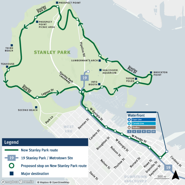
Proposed bus stop locations 📍
The route would start at Waterfront Station, travel along West Pender Street and West Georgia Street, then enter Stanley Park via Stanley Park Drive.
From there, it would loop through the park before returning downtown via the Stanley Park Causeway, West Georgia Street, West Pender Street, and Seymour Street.
In addition to existing stops downtown, the route would serve new stops within Stanley Park, including:
- Stanley Park Drive at Info Booth
- Stanley Park Drive at Totem Poles
- Stanley Park Drive at Lumberman’s Arch
- Stanley Park Drive at Pipeline Road
- Stanley Park Drive at Prospect Point
- Stanley Park Drive at Picnic Area
- Stanley Park Drive at Teahouse
- Stanley Park Drive at Second Beach
- Lost Lagoon Road at Stanley Park Causeway (existing)
Easier access to Stanley Park’s most popular destinations 🌳
This new route would make it easier to get to some of Stanley Park’s most popular spots without worrying about driving, parking, or long walks.
That includes direct or nearby access to:
- Vancouver Aquarium and the surrounding trails
- Stanley Park Totem Poles at Brockton Point
- Malkin Bowl for concerts and events
- Prospect Point for snacks, sips, and scenic views
- Second Beach
- Third Beach
- Lumberman’s Arch for picnics and gatherings
- Stanley Park Teahouse for a scrumptious meal in the park
Have your say at translink.ca/stanleypark until Sunday, May 31, 2026.
About time
I think small pickups with tiny benches are more practical and can be operated by volunteers or seniors etc.
Large buses in Stanley Park seem odd with long wait times with all the corporate strings attached.
With busy fifa summer one would expect 24/7 service from many different operators offering optional vehicles for more complicated family or handicapped etc