
TransLink Podcast: Walk this way — the art and science of wayfinding
TransLink Podcast: Walk this way — the art and science of wayfinding
Come behind the scenes with us as What’s the T: the TransLink Podcast with Jawn Jang reveals the voices and stories that drive Metro Vancouver’s transit system forward. Subscribe and listen everywhere you get your podcasts, including Spotify, Apple Podcasts, Pocket Casts, and Google Podcasts!
On this episode, we explore the intricate dance of maps, signs and more. We learn how they come together to help you seamlessly navigate throughout the transit system.
Learn more:
- Wayfinding 101: what is wayfinding?
- Wayfinding 101: story of the “T”
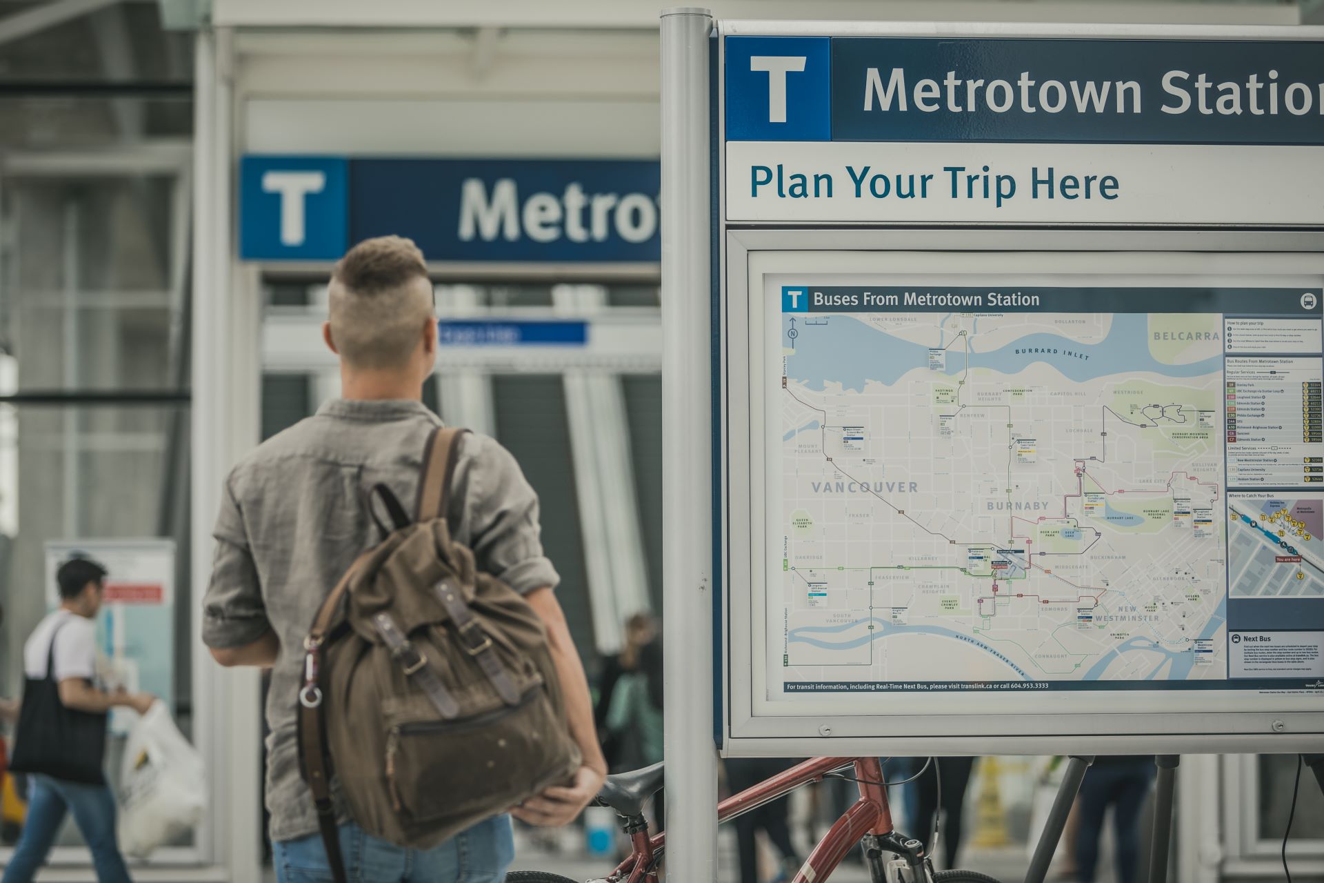
- Wayfinding 101: all about maps
- Wayfinding 101: progressive disclosure
- Wayfinding 101: the SkyTrain, B-Line and SeaBus Network map (in depth)
Transcript
HOST JAWN JANG: Hey, welcome to What’s the T, the TransLink podcast. My name is Jawn Jang. And on this episode, we’ll learn all about the tangible and intangible ways we’re secretly guiding you on your transit journey. It’s wayfinding 101, so let’s tap in to What’s the T.
[INTRODUCTION MUSIC PLAYS]
VOICEOVER 1: The next station is…
VOICEOVER 2: Welcome to What’s the T, the TransLink podcast.
JAWN: Every transit journey boils down to a simple formula you need to get from point A to point B in a convenient and timely manner. Arriving at your destination is the end game, the ultimate goal every single time you embark on your trip. But what if I told you that this simple formula is secretly very complex as your brain processes an incredible amount of information to make the best choices possible in order for you to arrive at your destination on time.
Those split second decisions during your trip is aided by what we call wayfinding. Let me explain it this way. Before you head out the door on your trip, you know the basic game plan — you probably have an idea which bus route you need to get on or which SkyTrain station you need to get to. Wayfinding is the system, or really, an art, of ensuring you know exactly where you are and exactly where you need to go next.
It’s the northern star of every transit journey guiding you along, whether you realize it or not. And to help explain wayfinding in more detail, we’re sitting down with Jada Stevens, Senior Advisor of In-System Customer Experience and Wayfinding at TransLink. Jada, let’s kind of start from the very beginning. Wayfinding. It’s a word, what does it actually mean? Just describe it and define it for us, especially in the context of public transportation.
JADA STEVENS: Now you say it’s a word, but if you look it up in the dictionary, I don’t think it’s actually in there.
JAWN: Oh, interesting.
JADA: And it’s my job title. So sometimes, sometimes I think deeply about that. But anyways, wayfinding is essentially the art and science and psychology of navigation and finding your way in a built environment, or in a, in a natural environment.
So, with wayfinding, it might be something you don’t realize you’re actually doing, but it’s something that we do all the time as we travel through space. I’m going to give an example of a grocery store because that’s something we’re all familiar with. If you’re looking for rice, when you enter the store, you know intuitively to look at those signs that are above those aisles. And so that is a tactic that the grocery store put there to ensure that you can find rice. You might ask somebody where the rice is, and that’s another wayfinding tactic. You might actually just walk up and down the aisles randomly looking for rice, but that is you, once again, practice wayfinding to find the rice. So, there’s a lot of things that people do to travel from point A to point B, but then there’s also the flipside of that, you know, if wayfinding is in my job title, what exactly am I doing?
I’m not telling people where to find the rice. But my job is to ensure that those tactics are in place for you. So, or sorry, that those tools are in place for you, so the signage is there when you need it. If you’re trying to find a bus stop, we have to ensure that those bus stops are, are recognize able and consistent and that the information has exactly what we need to have at a bus stop.
We plan the same thing for in SkyTrain stations, you know, we’ll let you know what platform is coming up. We’ll direct you to the exit. All of this is deliberately planned so that as you travel through the station, you don’t get lost, you don’t get stressed out, and you can easily navigate, you know, without a smartphone, without asking for directions, and, you know, travel on your way. So that’s kind of what we’re finding is it’s what you do as a customer. And then it’s what I do every day is ensuring that those kind of tools and tactics are in place for you.
JAWN: I love that. It’s like almost subliminal in some ways, right? Like because you kind of get used to a grocery store. Layouts are designed pretty consistent, whether it’s, you know, a certain chain or, you know, a different one. Like you walk into the grocery store, you kind of know what to expect, visually.
JADA: Yeah, that’s true. I mean, the grocery stores, shopping malls, airports, parking lots, they all have wayfinding integrated into those spaces. So, you can find your way through it, in and out of it, or onto any services or amenities they might have. So, people like myself, my, my work in planning those strategies for those large build environments and obviously TransLink, because we have a large region and we have a large subset of customers who are travelling through this region and needing information, we have a team here that that ensures that all the wayfinding tools are in place for you.
JAWN: So, when we’re talking about like building wayfinding, what are some of the key principles that you would try and follow if, if this is a practice, for example?
JADA: So, one that’s really key for wayfinding is called progressive disclosure and how I like to explain that is first, you don’t want to give too much information to somebody all at once because they might forget it, it might stress them out, they might confuse it with something else. And so progressive disclosure, in terms of navigation and wayfinding, is to present just the right amount of information where you need it and nothing else.
So as an example, let’s say you’re at a SkyTrain station that has two exits. One is Dunsmuir Street, one is Granville Street. When you’re at the platform, we will direct you towards the exit. And we won’t differentiate between Granville and Dunsmuir Street, yet, because you’re travelling through the tunnel, you’re walking down, you know, the pathway and you’re just travelling towards the exit. We don’t let you know about the Granville Street or the Dunsmuir Street exit until you get to that point in your journey where you need to decide, “Do I turn right or do I turn left?” Left might be the Dunsmuir Street exit. So that is where we will then have a sign that will differentiate, “Turn right for Granville and turn left for Dunsmuir.” So, it’s always ensuring just the right amount of information where you need it and not overloading it. Right?
JAWN: I kind of understand that too, because if you are like, just, I keep going back to the grocery store example, but it’s a good one. I think it’s very relatable.
JADA: It’s a good one.
JAWN: If you had like all these like, 15 signs, as soon as you walk into the grocery store, like this is where you got to go, this is where you got to go. At some point, you’re just like, I actually don’t know where I’m supposed to go. There’s too much chaos because I think that’s just maybe the reality of human nature. Like, we, we do get overstimulated. We get overloaded with information. So, I love the fact that we’re trying to find the right balance.
JADA: That’s right. Yes. You need to know, you know, where the cash registers are, but perhaps not when you’re at the back of the store. Right? You need you need to understand that you need to travel to the store towards the front. And then obviously, the information will be there to serve you, right? So, you always need to have, kind of, only a limited amount of information.
You’ll recognize it, it will help you inform a decision where you are. And if you have to make a decision on your journey, you know, 50 meters down the road, there will be perhaps another sign to kind of guide you and to influence you in your decision making.
JAWN: It’s one of those things where if there’s poor wayfinding, people notice, but when there’s excellent wayfinding, it goes like very under the radar. And I think that’s speaks volumes about the work and how important it really is, because good wayfinding has to be subtle, almost. So how do you define wayfinding and the ideal version of it?
JADA: Well, ideal wayfinding, you’re right, it should be something that you don’t really notice. It’s something that complements your day but doesn’t add any extra stress or cognitive pressure for you to experience as you travel through a space. So ideally, good wayfinding would be consistent, something you can trust, it would be something that you can understand very quickly, at a glance, and it helps you make very quick decisions without even really thinking. So that’s what I would say is the baseline for good, good wayfinding.
JAWN: And I think that’s such a crucial part because I mean, public transportation, if you live in this region and you take the same routes every day, you kind of learn over time like where you need to go. It’s just, you know, it’s human nature. You kind of do this, like, mental map as you head out the door and you’re on your way to work or school, whatever it may be, but if you’re somebody visiting from out of town, you’ve never been to Vancouver before and you’re relying on the public transportation system, wayfinding is so important. It’s a critical part of how you’re going to get around and explore the beautiful places around Metro Vancouver. So how do you balance, like trying to make sure that it’s not like overly aggressive for the people that take the system all the time, but also it is there and it’s very obvious and easy to find and access for people who might not have ever been in Metro Vancouver before.
JADA: Well, you’re right. That’s the challenge, is that you have to make wayfinding accessible and usable for everybody. And we aren’t all equal. So, you know, there are folks that live have lived here, used our transit system for, you know, years or decades, and they have a mental a cognitive map of, of where they’re travelling to, and they need very few wayfinding cues to serve them as they travel through the region. But folks who are visiting, you have to consider whether or not they speak English, what kind of tools they might bring with them, do they have a phone, do they have a map? Are they travelling with somebody who might be somewhat familiar, or have they been given directions and they’re kind of following kind of those directions? If they don’t speak English, how do you serve them? Right?
JAWN: Right.
So in in wayfinding, you have to apply a lot of tactics to kind of solve all of those all those issues. And we do that by using, you know, colour or icons or repetitive kind of language that, you know, should be intuitive to folks when they see it, right? We have icons that represent SkyTrain, one for SeaBus, one for bus. We have a very recognizable, usable, kind of brand for wayfinding so that if you become familiar with a bus stop in Langley, you’ll be able to find a bus stop in Vancouver, as they look the same. So, it’s those kind of simple, quick, almost visual cues that we plan so that people can recognize the transit network. Our job is to ensure that we have put in place very simple, recognizable kind of iconography and, and visual cues so that you understand the transit network, or that you can easily find the transit network as you’re travelling through it.
JAWN: And I think that is very true for my personal experience. I was born in Seoul, South Korea. And the thing about Seoul is that they have so many different bus companies, like so many, and they’re all different coloured busses, but some busses that are different coloured will still serve the same route. It becomes like this, logistics nightmare, because I actually do not read Korean, so I’m trying my best to like have this Kor-English this conversation with somebody who might be might be able to help me out. But, they’re just like, “yeah, just go by the colour.” I’m like, “I have no idea which colour leads me to where I need to go.” So, I’m glad that TransLink, you know, here at Coast Mountain, our partners at BCRTC, there’s consistency from station to station, from vehicle to vehicle. So yeah, like if, to your point, you get on a bus in Vancouver, you know how to do it. And when you get to places like Surrey, Langley, other parts of Metro Vancouver. Those are the visual cues. But to your point, you know, those with disabilities, we have to try and make the system as accessible as possible. So, there’s got to be other things beyond just visual because not everyone is able to see.
JADA: Well, that’s absolutely true. We have, a lot of our customers, have also all sorts of disabilities. We have folks with visual disabilities, cognitive disabilities, hearing loss, physical disabilities, and we have to serve them all and we have to ensure that information is accessible to them. So, some wayfinding tools or tactics that we deploy are audio announcements as a, as a, let’s say you’re in a train and you hear the next station. That’s, you know, serve those folks who maybe can’t see and they’re not seeing the map or they can’t see their location, but they can they can hear and, and recognize the through the chime that we’ve arrived at a station.
[SKYTRAIN CHIME AND ANNOUNCEMENT]: The next station is, Sapperton, doors will open on the right.
Train to, Production Way—University.
[AUDIO GUIDE]: Eight. Waterfront Station.
[BUS ANNOUNCEMENT]: Next stop, Goard Way and BCIT.
JADA: We have Braille signage. You’ll see that at bus stops all over our region. We’ve got Braille and tactile signage that communicates to customers the bus stop number, other crucial information, such as the bus routes that stop there and the TransLink phone number, gf they need to contact customer information for more assistance. You’ll see at SkyTrain stations and at bus stops will have tactile surfaces on the ground. Predominantly, you’ll see walking paths so that you can kind of trail a path with your cane and find an elevator, or an exit, or a platform, you know, if you’re not able to, to visually see where you’re going.
So, it’s really important that we include that as well. And then also we pay attention to nuances, such as colourblindness. So, we may present something for those who are able to see things, but perhaps they can’t see the difference in colour. A lot of our the icons that we use on our on our wayfinding signage and on our maps and things like that have been tested to ensure that they are contrasting enough from each other so that you can see the information clearly. You want to ensure that if there is a blue and a yellow, when tested for somebody with a visual colourblindness deficiency, that there’s enough contrast between those two colours, so that they can identify what is on that map or what’s on that sign. So, to some extent, there’s a lot of science that’s behind it. It’s not just art, it’s not just design. It’s not just putting up a sign, or just designing a map, but it’s really, you have to first understand the customer, how they think, any kind of limitations that they might have to be able to travel independently, and then you have to follow, often, it’s standards that already exist that are put in place by, let’s say, the Canadian National Institute of the Blind to ensure that the information we put out there is accessible to specific user groups.
JAWN: Wayfinding is a beautiful paradox because what sounds so simple is actually so very complex. Finding the balance between being inclusive and sufficient without being overbearing. But, what about the bigger picture? How does TransLink wayfinding hold up to some of the other systems around the world? We’ll dive into that next on What’s the T, the TransLink podcast.
[PAUSE]
JAWN: Welcome back to What’s the T, The TransLink podcast. We’re in conversation with Jada Stevens, Senior Advisor of In-System Customer Experience and Wayfinding at TransLink.
Obviously, I’m very biased. I’m TransLink employee but feels like we do a pretty good job of making sure the system is robust, accessible, that wayfinding isn’t a difficult endeavor for people, but how do you think we compare with some of the other major cities across Canada? Like have you had a chance to visit places like Toronto, Montreal, Calgary, Edmonton, and maybe even have a chance to go on other places around the world, even as a tourist, just to be like, “Oh, okay. So that’s how the public transit system works for those that might not have ever been there before.” Right? Going back to the wayfinding thing.
JADA: No, it’s true, actually. I think in Vancouver we do it quite well and obviously working in wayfinding, there are big ideas that we have that we want to push and get going so that we can do it better. And we’re always listening to our customers and looking for those opportunities. But I have travelled, and I have seen other agencies that are doing it very well. Recently I was in Victoria and I was very, very pleased with the bus stop wayfinding that they have. For any folks who’ve been there recently, you’ll have seen that they’ve implemented route maps at their bus stops, which is something we haven’t done here. We’ve had a lot of discussion about that and how do we implement it when we have 8000 bus stops, but I was very pleased with that as being a visitor to Victoria, being able to see, that’s where the Route 30 goes.I get it. Now, I understand and I would love for us to be able to do something like that here. Of course, there’s a lot of complexities involved, but it’s great to see, you know, a B.C. agency pushing the boundaries in that respect.
It’s funny, you go to places like New York City and London where, you know, New York City in particular, I would say they’re not known necessarily for having the most innovative wayfinding, and their transit system has a lot of gaps in it, and we all know the stories. But it’s super intuitive to travel by subway there. Their subway maps are recognizable. They use very simple kind of coding and colour structure on their maps. You can really easily tell where a subway line is going and where they connect to other lines or other modes. So, well done to New York City for doing that. They also have great signage in their subway stations.
London as well. Huge, massive network there. And Vancouver, when we first developed her wayfinding standards just prior to the Olympics, we really did look at London and Europe quite a bit to centre how we provide wayfinding here. And so, you’ll notice in London they have a lot of on the walls, they’ll have a lot of, what we call line diagrams. People call them maps, but they’re essentially maps that tell you what stations are ahead on the line you’re at, and how to get to it within the station. Because those stations are so complex, they’re underground, they’re like a spider of, of connecting, you know, tunnels, and for a visitor, it’s very easy to get through it, and I absolutely love that. I feel like every time I travel to London, I can just trust that I can get through it without any, without any stress. And like, really, at the end of the day, that’s what wayfinding is about, to ensure you can trust and not have any stress.
JAWN: I haven’t done as much travelling as I would like. I haven’t been to London, I have been to New York, and I have taken the subway and I think I totally agree with what you saying, like it is intuitive. But the London system, you know, like the, the Tube might be one of the most, like, famous transportation networks in the world.
So, if that’s like the standard that we’re working towards here in Metro Vancouver, you know, I think that’s a great standard to follow. That word, also, “wayfinding standard”, you mentioned that TransLink developed it shortly before the Olympics. I’m sure that was done intentionally as the world was arriving in our city, in this region, for two and a half weeks to see, you know, the greatest athletes compete and perform. What role do you think the Olympics really played in making sure that we tried to be as welcoming and as a supportive as possible for people of all different backgrounds and all different cultures and all different languages?
JADA: Well, Jawn, I love that question because it’s a really great story and I’ll go into kind of the history of wayfinding, but you did speak previously a little bit about travelling to Seoul and how you found it confusing because there’s all of these, kind of, connected but separate modes and organizations that deliver transit there, and you’re not really sure, like, are they one? Are they distinctly different and how do I travel through it? And I think prior to the Olympics, to some extent, TransLink had that same identity crisis, in that we had the SeaBus, we had the bus, we had, you know, the Canada Line was coming on, we had the SkyTrain, Expo Line and Millennium Line, and we had all of these visitors coming.
And there was the question that would come up, “Can I take the SeaBus if I paid for the bus? Can I get on the SkyTrain? How do I get around? How do I connect? Are they one transit system or are these all different?” And so, to start it, TransLink really had to look at kind of their brand. You know, first of all, how do customers recognize transit in in our in our region, and then how do they recognize the modes? And they wanted customers to really understand that you could pay for, you know, pay for the bus and use that same fare media to then get on to the SkyTrain. And in doing so, they developed what we all know as, what we call the “T”, the “blue square T” as the kind of primary visual identity, which means T for transit. And that, as you now will see, is found on all of our bus stop signs, at the entrances to all of our stations, you’ll see it on all of our maps and…
JAWN: You’ll hear it in the name of this podcast…
JADA: It’s everywhere, right? Like, it’s exactly, like it’s become it’s a big thing on its own, but once upon a time it didn’t exist. So, the “T” became it was kind of first it was it was kind of the leading kind of the leading representative of what, you know, will be transit for our customers. And then from that we then developed a full wayfinding visual identity.
So, that’s where we started bringing in icons that represent SkyTrain, and bus, and colours, and we developed maps that are kind of consistently designed and we have those same consistent maps on bus versus, at SeaBus. And then we started developing a wayfinding standard, so this is a 13- page book that really defines how we deliver a visual wayfinding strategy for our customers and what that looks like,
JAWN: Right.
JADA: So that is always consistent. You know, you don’t want to have too many competing visual identities, because then you have the Seoul example.
JAWN: Right.
JADA: So, you know, if you recognize a bus stop sign, you know, we use the same colours and typography as in the stations, and that’s very deliberate. It’s very important to wayfinding that we present all of our modes as, kind of, one consistent service for our customers.
JAWN: I love hearing that. Do we know what the name of the TransLink font is when it comes to typography? Producer Allen would you happen to know that? Maybe Jada, you would know?
JADA: It’s Meta, Meta OT.
JAWN: Meta OT. Okay, so for those that are listening, perhaps you want to, I don’t know, start using TransLink font on your research papers.
JADA: That’s a great idea.
JAWN: But I love that you would kind of explain the history of the blue “T”. You’re explaining what’s the “T” on What’s the T? So, I love the fact that we’re doing something very meta.
JADA: Meta.
JAWN: So that’s, that’s kind of brilliant. I mean, at the end of the day, I think, you know, I love the fact that, you know, access transit is such a big part in communicating with the organizations and communicating directly with customers to know like, “How can we better serve you and how can we make sure this public transportation system in Metro Vancouver?”, which we know, it’s a growing region each and every year, more and more people are going to start moving here, they already have. So, we need to make sure that the system is robust, strong and it’s nimble because I’m sure, Jada, like technologies change, new things are coming through all the time. That must be exciting for you and your team because you’re kind of keeping your eye out and trying to look around and seeing like, what new things can we implement just to make sure that the experience of getting from point A to point B is that much easier, that much smoother for, again, not just the seasoned transit users that have lived here all their lives, but especially for those that are just kind of doing it for the first time, right?
JADA: That’s absolutely true. And I think we’re in a really exciting time right now. We’re kind of exiting this day and age of everything being analog, into this world of things being digital and experiential. And that’s really where I’m hoping that we can get to with a lot of our customer information, perhaps more digital signage, perhaps more kind of interactivity with any information that you might need when you’re actually within a station or at a bus stop, right? So that you can call up the information that you need in the place that you’re at, and not just expect that perhaps there’s something printed that’s there.
JAWN: Right.
JADA: But something that you can more, you know, call on to get information that relates specifically to your journey.
JAWN: The next time you embark on your transit journey, you may start to recognize and identify all of the ways that wayfinding works for you. Consistent signage, icons, and strategic placement of all of these things, all designed to keep you moving along with as little disruption to your trip as possible. Now, just remember this “under the radar navigation system” requires teams of brilliant, dedicated professionals who strive to deliver the very best transit experience for you and everyone else.
Because as we know now, the commuting experience is more than just going from point A to point B. Without proper wayfinding, you might constantly find yourself at point C, or point F, or somehow right back at point A all over again. My point being, every successful trip, is successful wayfinding.
My thanks to Jada Stevens for her time and expertise on the subject, our entire Customer Experience and Wayfinding team at TransLink for the hard work they do behind the scenes. My thanks to producer Allen for always pointing me in the right direction, and finally, you, for listening and subscribing. My name is Jawn Jang and until next time, have a safe trip.